![[Earth]](../img/earth.gif)
PEM West A Maps
![[GTE Logo]](../img/gte_slogo.gif)
|
PEM West A Maps |
|
|
|
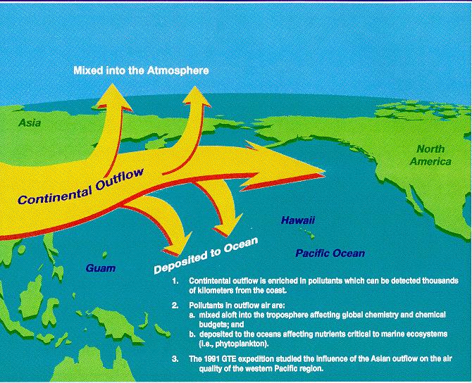
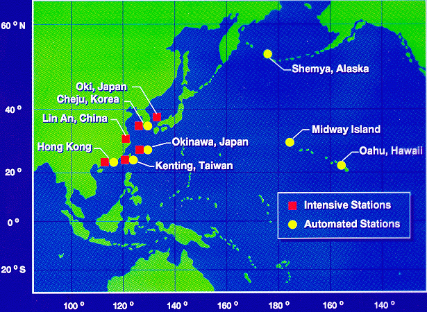
The PEM-A study was deployed in September-October 1991 to study the emissions from the Asian Continent during a seasonal period characterized by minimal outflow from the continent. Measurements during this period provide a baseline from which the measurements during PEM-West B can be viewed. Ground measurements (below) at selected sites in the Pacific provide a longer time record of emission from the Asian continent an complement the more intensive measurements provided by the instruments aboard the DC-8 aircraft. |
|
|
| Time History of Ground Measurements Not Available |
Measurements at the automated ground sites were typically filtersamplers operational throughout the year. Instrumentation at the intensive sites typically required more frequent service/calibration and were therfore only active during the intense airborne phase of PEM-West A. Results from those measurements provide a time histroy record which clearly show the seasonal variability of emissions from the Asian continent. |
[Return to the GTE
Home Page]
[Return to the PEM West A Flight Map]
[Feedback]